things i build for cities
North Carolina zoning atlas
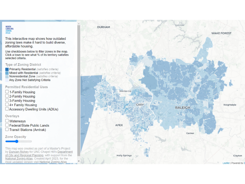
A map of 389 zoning districts across Raleigh and Cary, built from 1,500 pages of ordinance text, to make local housing rules legible.
Zoning is the quiet thing that decides what can get built where you live, and it’s written across 1,500 pages of ordinance that almost nobody reads. For my Master’s project I tried to fix the readability problem the only way I could think of: I read all 1,500 pages and turned them into a map.
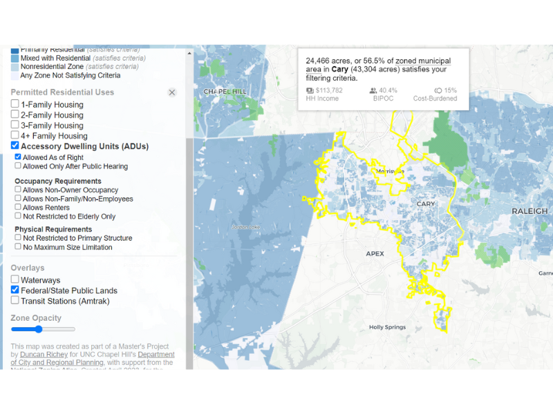
The finished atlas covers 389 zoning districts across Raleigh and Cary, the two big neighbors in North Carolina’s Triangle, home to about 650,000 people. Once the rules are a map instead of a legal document, the differences jump out: how much more freely one city allows multi-family housing than the other, or where an accessory dwelling unit (a backyard cottage, basically) is and isn’t legal. That’s not trivia. It’s a big part of why housing costs what it costs.
The data fed into the North Carolina Zoning Atlas and the broader National Zoning Atlas, which is the part I’m proudest of. It stopped being my class project and became something advocates and legislators could actually use. You can open the live map below, or read the full paper if you want the methodology.